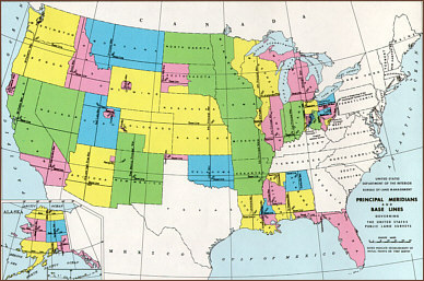
The illustration below provides a sense of how the principal meridians
and base lines have been employed across the United States to provide
standardization and orgranization to the enormous task of cadastral
survey. Scroll down to see a closeup of the Arizona - New Mexico area.
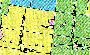 This
illustration shows the base lines and the Gila and Salt River and New
Mexico Principal Meridians in Arizona and New Mexico respectively.
This
illustration shows the base lines and the Gila and Salt River and New
Mexico Principal Meridians in Arizona and New Mexico respectively.
